Now that I have access to photo uploading again, I've uploaded a few photos from the Bike tour.
Up above is a map of route we took from Vernon to Penticton. The green bubbles represents the overnights we had. The average distance between each of the bubbles is just over 100 kms.
Here are some photos that I took between Penticton and Hedley. The ride to Hedley was very hilly, but nothing like the next day would be! We camped 5 kms West of Hedley as the headwinds were slowing us down and making us both very tired. As I was so tired, I treated myself to an ice cream in Hedley first, to motivate me to bike the little 5 kms more.
At the campsite, a lady from Calgary, treated me and Jim to homemade Blueberry muffins and some Peppermint tea. Yum!
 |
| 1960's British foldup in Penticton. Anyone know the manufacturer? |
 |
| Scenery on Highway 3 (Crowsnest) |
 |
| Yet another hill to go up! |
 |
| On top of one hill on my way to Hedley |
 |
| Friend of Jim's in Keremeos live in an old RCMP building |
 | ||
| Same amount of distance to Vancouver as we did on Tour De Jasper |
 |
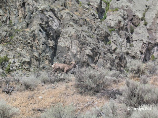
| Saw a Mountain Sheep |
 |
| Gold Mining town of Hedley |
 |
| For all my Wizard of Oz fans out there |


No comments:
Post a Comment